Saturday 9 April 2016

Pre-Clovis Archaeological Sites of the Americas 7: Santa Elina Rock Shelter, Mato Grosso, Brazil 25,000BP


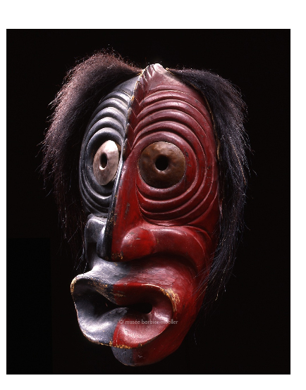
As readers of this blog must be aware, I am quite fascinated by the peopling of the Americas. I often look at websites which take an unbiased view of the possible evidence of the earlier claims of man in the Americas. Of particular interest is the Center for the Study of the First Americans (CSFA). A marvellous resource is their archive of the publications Mammoth Trumpet and Current Research in the Pleistocene. They are often a goldmine of information about less well known archaeological sites. Recently, while reading a back issue (1) I came across information on a site I have long been interested in: Santa Elina rock shelter in Brazil.

The rock shelter was first discovered due to the thousands of both geometric and human figures, such as this one from Vialou (6):


One of the 1000’s of human figures and geometric designs up to ca. 10,000 BP painted at Santa Elina rock shelter from Vialou (6), original caption: Rock Shelter, Santa Elina: Indian painting.

Here’s the information from the Mammoth Trumpet article:
“Another Brazilian site, the Santa Elina rockshelter, located in central Mato Grosso state, has produced early radiocarbon and thermoluminescence dates on stratigraphic levels containing remains of Glossotherium (a giant ground sloth) and associated lithic artifacts. This large limestone rockshelter is currently under excavation by Agueda and Denis Vilhena Vialou; and only preliminary reports are presently available (2).
To date, three major units have been identified in the known stratigraphic record. Unit III, a 60-cm-thick sandy deposit with rock rubble, is subdivided into four subzones. Bones of one individual Glossotherium, together with thousands of osteoderms (small spherical bones within the skin of a ground sloth), were found clustered within a limited area in subzone III-4/3, in association with 27 retouched tabular pieces and percussion flakes of limestone or flint. Notched or denticulate tools are common in the assemblage, and some pieces show use wear. There are also ca. 50 unmodified percussion flakes. Also found on this level were several small quartz crystals and a hematite fragment. Two of the sloth osteoderms feature smooth circular perforations, and the faces of one of these show abrasion.
Radiocarbon dates of 22,500 ± 500 RCYBP and 23,320 ± 1000 RCYBP have been obtained on wood recovered by flotation from stratigraphic subzone III-3/2, just above the level of the lithic artifacts and sloth remains in subzone III-4. A sample of osteoderms from subzone III-4 was dated at 27,000 ± 2000 yr B.P. by the
uranium/thorium method. Further AMS dating of charcoal and OSL dates on sandy sediments in subzone III-4 are reported to range around 25,000 years ago.
The III-4 subzone is at a depth of ca. 3 m within the rockshelter fill. One meter above, separated by virtually sterile deposits, is a younger occupation level (in Unit II-2) with Glossotherium bones and ca. 200 lithic artifacts. This level has produced a radiocarbon date of 10,010 ± 60 RCYBP on charcoal from a hearth. Research at the Santa Elina rockshelter continues, so we must await final results. As of the 2003 report, bedrock had not been reached.”

Location:

About 100km north west of Cuiabá the capital of Matto Grosso state.
 
 
Location of Santa Elina rock shelter within South America. Left hand map of the continent adapted from Cione (3) showing that surrounding region at the height of the Last Glacial Maxima (LGM at ca. 20Kya BP) was a mosaic of open forest and savanna. Right hand map adapted from Bachelet (4), showing similar current vegetation known as cerrado.
Environment
According to Cione at al. (3), the habitat in the region of the central Matto Grosso was similar to that of the present if a little cooler around the height of the LGM. Today the habitat in the area of Santa Elina rock shelter is described by Bachelet and Scheel-Ybert (5) as “This region is dominated by the Cerrado biome, comprising wooded savannas (cerrado stricto sensu, veredas), park and gramineous-woody savannas (campo sujo, campo rupestre, campo limpo), and forest formations (riparian forest, dry forests, Cerradão). The local landscape is defined by deciduous and semideciduous forests, cerrado, riparian forests, and anthropogenic areas (deforested areas, pastures) (Ceccantini, 2005). The climate is tropical hot (Aw in Köppen classification), with a dry season of 4-5 months from May to September; mean temperature is 250C, with maxima over 400C in the summer; mean precipitation is around 1700 mm.”


Cerrado types (Portugese) from Ecel Capoeira blog (7).
Santa Elina excavation details
The main publication about the Santa Elina rock shelter is that of Vialou (8), who excavated the site between 1985 and 2005. Unfortunately he published his discoveries in a monograph, in book form, in Portuguese and thus is unavailable to me. Unlike the situation with many other American archaeological sites there are few papers by about this site available on the internet. Thus details about the excavation must therefore be gleaned from translations of French papers by Vialou and Vilhena Vialou or from secondary sources.


Excavations at Santa Elina rock shelter. The cave is ca. 60 m long and situated in the Serra das Araras at the base of a  Precambrian limestone bed of dimensions 40 to 50 km wide, up to 800 m high and 500 km long. The cave is tilted in both longitudinal and vertical axes as shown in Vialou (6), original caption: Fig 1. Rock Shelter, Santa Elina: long stratigraphic sequence, 25 000 years to 2000 years BP.


The discoveries were summarised by Bachelet and Scheel-Ybert (5) thus:
“Three main archaeological assemblages were identified in the stratigraphy: The upper archaeological layers (assemblage I), containing the more recent occupations dated between 2000 and 6000 BP, are characterized by the exceptional preservation of many plant remains. The anthropogenic sediments, fine and powdery, are formed primarily of ash. The site shows habitation structures, numerous combustion structures, rich in charcoal and sometimes containing fruits and other plant remains, food remains, lithics, and adornments. Fruits, seeds, braided fibres and ropes, artefacts such as sandals, penian sheaths, and packages, wooden stakes, wood, charcoal, and even leaves abound. Lithics and pigments are very common (Vilhena Vialou, 2005).
An intermediate archaeological layer (assemblage II) was dated between 6000 and 10,000 BP, when several human groups are thought to have succeeded each other in the shelter. In these levels, sediments are sandy and non-charred plant remains are rare. The material culture is characterized by lithic material, extinct fauna remains of Glossotherium lettsomi, several hearths, and charcoal (Vilhena Vialou, 2005). The lower archaeological levels (assemblage III), dated to the Late Pleistocene (22,500 ± 500 BP), present are many megafauna remains of G. lettsomi, frequently identified in direct association with lithic material. The sediments are sandy and stony, and plant remains are scarce. Only lithics and a few fragments of charcoal dispersed in the sediments were retrieved (Vilhena Vialou, 2003, 2005).”
A useful stratigraphic diagram is also included in their paper:
 
Stratigraphic profile of Santa Elina from Bachelet and Scheel-Ybert (5), note caption for level III4 ‘couche a megafaune’ dates to 27,000BP - at variance with the text giving a date of 22,500BP. Original caption reads: Fig. 3. Schematic stratigraphic section of the square 29-ABCD in Santa Elina rock shelter, representing the three archaeological assemblages: “assemblage I” (2000-6000 yrs BP) top gray; “assemblage II” (6000-10000 yrs BP) in white; “assemblage III” (around 25000 yrs BP) bottom gray (from Benabdelhadi, 2005).
Vilhena Vialou and Vialou on the archaeological finds made:
“For various occupation floors uncovered at the base of the upper sequence, dated by 14C between 9,400 and 10,120 years BP, is associated with a well characterized lithic industry: many breakdown products (cores, flakes, cassons), mainly of silicified limestone but also of flint and sandstone, all rocks encountered near the shelter, within a few hundred meters; some quartz fragments, material taken in small outcrops visible in the mouth of the canyon, about 2 km from the site.  The tools consist of summarily retouched pieces and notches, cruder than at higher levels, also produced little except some remarkable pieces such as large projectile points (Vilhena Vialou and Vialou 1994 Vilhena Vialou et al. 1999; Vilhena Vialou 2005; Aubry 2005).
In this large occupation floor of 30 m2 extent, lithic pieces are clearly associated with many skeletal remains of a giant sloth (Glossotherium Letsomii), a species of the South American megafauna that became extinct at the end of Pleistocene.
The lower sedimentary layer of the chrono-stratigraphic sequence was also stripped of 30m2 between 2.80 and 3.50 m depth from the current surface.  The anthropogenic remains are in a compacted sediment amongst large weathered limestone blocks.  In places, a thin slightly greyish film contains fine ash and micro-fragments of coals.
The level of human occupation floor contained about 200 lithic pieces and, in abundance, the bones of Glossotherium.


Lithics from the lowest human occupation levels at Santa Elina rock shelter. Image source Vialou (8).
Osteoderms (dermal bones of 1 to 4 cm in length), revealed the number of 5000, were repeatedly grouped into small piles by prehistoric man.  Some are broken and two were redesigned conclusively by abrasion of their natural surfaces; these may be ornamental elements.  About 200 bones mostly, split are anatomically identified: ribs, vertebrae, maxilla and mandible.  They show that only the front part of a single animal was introduced into the occupation.  The animal died naturally or was killed by hunters, or was carrion was brought into the shelter (Vilhena Vialou et al 1995. Vilhena Vialou 1997-1998 Vilhena Vialou 2003 and 2005; Cartelle 2005).
 
Glossotherium osteoderm [Glossotherium chapadmalense] from López-Mendoza (9). Original caption: Figure 7a. : An undamaged dermal bone from Baño Nuevo-1;
 
The three dating methods have used at the site: Uranium-Thorium on osteoderms of Glossotherium, optical stimulated luminescence (OSL) on the quartz grains of sediment coating the archaeological and faunal material (with dosimeters placed in the layer section), accelerator mass spectrometry (AMS) from micro-charcoal collected in the layer.  These three methods have provided dating around 25,000 years BP.  A Uranium-Thorium dating attempted on osteoderms collected in the upper  archaeological hearths of the upper layers has provided a date of around 13,000 years, corresponding to 10,000 years BP obtained by 14C dating.  Similarly, OSL dating on Glossotherium remains of the sandy levels inserted between the two occupations gave interim dates.  The intercalibration of the three methods (both being the lower limit of their validity) gives a result that further strengthens the remarkable dating of anthropogenic deep level, the oldest now obtained in archaeological contexts is stratigraphically well established ( Falguères 2005 Feathers 2005 Fontugne, Hatté and Noury ​​2005 Valladas 2005).”
 
Some authors such as Bueno, et al. (10), comment on the lithic assemblage from Santa Elina:
“During the 10th 14C millennium BP, the Itaparica Tradition reaches its greatest spatial extent in the cerrado and caatinga biomes of the Central Plateau and Northeast. On the Central Brazilian Plateau there are at least 23 known occupation events, fairly evenly distributed across that time range. With three exceptions e Santa Elina, Morro Furado and Boqueirão do Soberbo - all the occupied sites can be associated with the Itaparica Tradition.
..There is one site in this period in Central Brazil that we cannot assign to the Itaparica Tradition: Santa Elina, MT. The site is a limestone rockshelter, located at Serra das Araras, 100km northeast from Cuiabá, MT. Based on a series of different samples that have been dated by different analytical methods, the researchers responsible for work at this site have defined four main periods of occupation, extending from 25,000 14C BP until the colonial period (Vialou, 2005). During their second period, between 10,000 and 7000 14C BP, one of the most important aspects of the lithic assemblages is the virtual absence of formal artefacts. In all levels related to this period a lithic assemblage predominates with simple and cortical flakes made of limestone, chert and quartz. These raw materials are all found in the vicinity of the rockshelter and the flaked limestone is the same as the rock of the rockshelter. Most of the flakes were used without retouch; when it is present, it is frequently marginal, producing small and abrupt edges. Beside the absence of retouching and the short extension of the edge, most of the flakes are large and wide, offering very robust cutting edges (Vialou, 2005).”
 
Verdict:
1. This site is little known outside Brazil and France due to the dearth of published material in English. The main source of detail is Vialou 2005, a monograph in book form published in Portuguese. Some review article has been published in French. Consequently it is a little hard to assess the the quality of the evidence to support the dating of the site to 25,000BP.
2. Secondary sources largely lend support to the site as being occupied by humans who utilised Giant Ground Sloth for food at 25,000BP.
3. The three independent lines of dating strongly support each other lending weight to point 2 above.
4. The lithic assemblage is unusual. It seems more primitive than the well-known and recorded Itaparica tradition. This fits well with the early dates obtained by the investigators of the site: If the site is early it should have primitive lithics.
5. The lithic style of tool production changed little over a long period of time. A similar phenomena has been noted at similarly controversially early dated site such as Pedra Furada.
6. If the site really IS as old as 25,000BP who were the people that occupied it and why did their lithic toolkit change so little over thousands of years? Perhaps they represent an earlier wave of migration into the Americas by archaic Homo sapiens?
 
See Here for a post on human migration rate and the possible early entry date into the Americas.


References
1.  Gruhn, R. 2007. The Earliest Reported Archaeological Sites in South America.
The Mammoth Trumpetv 22/1, Center for the Study of the First Americans Department of Anthropology, Texas A&M University.
 
2. Where the South Winds Blow, the 2003 CSFA publication edited by Laura Miotti, Mónica Salemme, and Nora Flegenheimer).
 
3. Chione, A.L. et al. 2010. Did Humans Cause the Late Pleistocene-Early Holocene Mammalian Extinctions in South America in a Context of Shrinking Open Areas? In American Megafaunal Extinctions at the End of the Pleistocene, G. Haynes (ed). Springer Netherlands, 2010
 
4. Bachelet, C. 2014. Pré-História no Cerrado: Análises antracologicas dos abrigos de Santa Elina e da Cidade de Pedra (Mato Grosso) [Prehistory in the Cerrado: Anthracological analysis of Santa Elina and Cidade de Pedra rocks shelters (Mato Grosso)] FRONTEIRAS: Journal of Social, Technological and Environmental Science v.3, n.2, jul.-dez. 2014, p.96-110.
 
5. Bachelet, C and R Scheel-Ybert Landscape and firewood selection in the Santa Elina rock shelter (Mato Grosso, Brazil) during the Holocene. Quaternary International xxx (2015) 1-9 · JANUARY 2015. DOI: 10.1016/j.quaint.2015.12.019
 
6. Àgueda Vilhena Vialou et Denis Vialou, « Peuplements préhistoriques au Brésil », Les nouvelles de l'archéologie [En ligne], 111/112 | 2008, mis en ligne le 15 juin 2011, consulté le 05 avril 2016. URL : http://nda.revues.org/214  ; DOI : 10.4000/nda.214
 
 
8. Vilhena Vialou, A., 2005. Habitat e cronoestratigrafia. In: Vilhena-Vialou, A. (Ed.),
Pre-historia do Mato Grosso, vol. 1. Santa Elina. Edusp, S~ao Paulo, pp. 87e102.
 
9. López-Mendoza, Patricio and  Mena-Larraín, Francisco. 2011.
Extinct ground sloth dermal bones and their role in the taphonomic research of caves: the case of Baño Nuevo-1 (Andean Central Patagonia, Chile)
Revista Mexicana de Ciencias Geológicas, vol. 28, núm. 3, pp. 519-532 Universidad Nacional Autónoma de México Querétaro, México
 
10. Bueno, L., et al., The Late Pleistocene/Early Holocene archaeological record in Brazil: A geo-referenced database, Quaternary International (2013), http://dx.doi.org/10.1016/j.quaint.2013.03.042


Saturday 2 April 2016

More False Face masks from the Iroquois

I cited a paper by Jean Hendry (1) in my post about Native American mythological art (see Here). Originally written in the 1950’s it remained unpublished until 1964.The variety and exquisite nature of the False Face masks shown in the paper was quite breath-taking. Therefore I show some of them below as the images are almost unknown today.
 
 
On the origin of the masks Hendry recounts a number of facts, noting initially that they may have been as late as the 1600’s in their first use by the Iroquois.
 
On first observation by Europeans:
 
“The first positive evidence of false faces among the New York Iroquois comes from De Nonville in 1687. Writing about the Seneca he says, "They make some very hideous masks with pieces of wood which they carve according to their fancy . . . one foot and a half wide in proportion. Two pieces of kettle very neatly fitted to it and pierced with small holes represent the eyes. . ."”
 
Whilst Hendry attributes the above quote to De Nonville i.e. Jacques-René de Brisay de Denonville, the Marquis de Denonville, it is more likely quote originates from De Baugy (2) who was the Marquis’ aide-de-camp.
 
Hendry explores the probable earlier use of the False Face masks in the prehistoric period:
 
“The fact that the first travellers and missionaries found no public use of masks, and for a long time knew of none among the Iroquois, led Fenton (3) and Beauchamp (4) to the conclusion that false faces and their rituals made their appearance among the Seneca in western New York not earlier than the middle of the 1600's and from there spread slowly eastward to the other four tribes. Those students who take issue with this theory find support for the antiquity of masks in archaeological materials.
Parker (5) cites the small stone masks and the faces on pots and pipes, some of which he takes to represent masked figures. In his opinion, this evidence and some accounts of idols in the early 1600's that may refer to masks are proof that the Iroquois masking complex can be dated before the period of White contact. Converse and Keppler (6) take the same view and point out that the failure of early writers to mention masks is no guarantee that they did not exist at that time, as it is probable that the first Europeans were never permitted to see a mask or to witness the more secret ceremonies in which they were used.
The new archaeological evidence bearing on the problem of Iroquois provenience has done much to resolve previous differences of opinion. The probability that Iroquois culture originated and developed in New York State, and the discovery of representations of masked faces on clay pipe bowls in prehistoric Iroquois sites near Onondaga, offers support to those who insist that masking was an indigenous and ancient trait.”
 
Amongst the False Face masks accompanying Hendry’s paper were these:

 
False Face mask of the Iroquois from Hendry (1) plate 100a
Original caption: Crooked-mouth mask.
 
It is important to note the fact that Hendry did not give an attribution to this mask in terms of the exact source of the image, or any of the ones which follow. She comments thus: “I had hoped to obtain some information concerning the artistic standards of the carvers by showing them photographs of masks which have been made on the reservation during the last few years. This plan was blocked by difficulties of an interpersonal sort since after I had taken pictures of a group of Onondaga masks, the carver who had originally given me permission to do so was told that under no circumstances should he allow Whites to photograph them [possibly by Pete Hest - see note at the end of this post]. He asked me to refrain from mentioning to anyone that I had already taken pictures, a request which obviously prevented me from showing them to my other informants. However, I was able to use photographs of Iroquois masks which I had obtained from museums, and I found them very effective as a means of eliciting the carvers’ judgments and opinions about masks and as a rapport device.”
 
Thus the best photos in Hendry’s paper seem to be from museum collections or earlier sources (see refs 14-19 for possible sources). It is interesting however, to compare the above image with that of the cover photograph from Fenton’s 1991 book (7). It seems to be the same mask.
There are several other interesting masks. Here is the next:
 
Hendry (1) plate 100b. Original caption: Tongue-protruding mask.
Hendry (1) plate 103. From the style probably Seneca. Original caption: Straight-lipped wooden mask.
 
Hendry (1) plate 102. Original caption: Onondaga 1888 De Costa Smith (8) tongue-protruding masks.

Update:
I had assumed that these masks would be illustrated in one of De Cost Smith's publications. However having consulted the relevant works I find no illustrations of these masks. I can therefore only conclude that these masks were collected in 1888, as it is well known that De Cost Smith collected masks.
 
Hendry (1) Plate 103. Original caption: Husk Face Society mask.
Other Iroquois False Face masks culled from internet:
 
 
False Face mask. Image Source: Ethnologisches Museum, Berlin.
 
 
False Face masks of unknown origin and provenance, however the left hand mask is almost certainly the same as the image above, therefore it seem likely they are both from the Ethnologisches Museum, Berlin.
Image source: Iroquoisantroinfo (9)
 
False Face mask, age and tribal source unknown. Original image from pinterest, (10) but re-posted from the auction site Dorotheum where the item was presumably for sale. The item is no longer listed and therefore assumed sold.
 
 
False Face mask Musee Barbier Mueller, Geneva, Switzerland (11).
 
 
These last four masks illustrate the dual problems that the Iroquois tribes face today, some of their ‘live’ masks - that is those that have been used in ceremonies, by their makers embody the spirits of the False Face himself and are therefore seen as sacred. Tribes have therefore sought their return from museums. In the USA and Canada, this has often been achieved, especially from museum collections. Private sales still occur in the continental USA, and prices for genuine masks have ranged from $1000-$12000 in 2015.
An example of the Iroquois attitude is the statement on the Support Native American Art website (12):
“Many Iroquois masks have produced and sold to collectors and tourists. The Iroquois leadership responded with a statement against the sale of these sacred masks and called for their return. Traditional Iroquois object to labelling these as masks since they are not "things" but the living representations of spirits. It is considered sacrilegious to sell, publicly display or mimic sacred False Face Iroquois masks.
Some Iroquois carvers carve "non-live" masks made especially for sale, but traditionalists disapprove of this as well. All are in agreement that it is profaning the Iroquois religion to buy or view living masks, including antiques, or non-native forgeries.
I do not have a picture because public exhibition of all Iroquois Masks is forbidden.”
An alternative view comes from an Iroquois carver Chief Jacob Thomas (13):
“I am responding to your letter of October 3, 1994 requesting clarification of masks being sold to galleries, collectors and other institutions.
First of all in the past the people carved different forms of art to help support their livelihood. Particularly today as there are no jobs this maybe the only source for the people to make a living is to sell their art. Therefore many people do carve and sell their art. I believe that this is an honest thing to do rather than living on welfare or having to steal to provide for one’s family.
The masks that I carve are not “blessed” nor given any power for healing, and there is nothing wrong to sell these masks. On the other hand, I do agree when the people say that sacred masks should not be sold. Sacred masks are blessed and given power to heal and cure. This is not a religious practice but it is a tradition that has been passed on from generation to generation.
People are very critical but they overlook the practice to sell native medicine, to compete in native dances, and to sell their culture by smudging and selling lacrosse sticks (its medicine too). Today lacrosse sticks are sold and played all over the world.
If masks are forbidden to be sold and it becomes too sacred then it will become a secret and no one will be able to carve a mask and know what it means and it will become lost among our people.
This is the way I make my living I carve many forms of art and I make an honest living. If there is anyone out there who needs more information they can contact personally. I hope that clears the confusion.
- Chief Jacob Thomas”
 
That was in the 1990’s. But where did this prohibition about selling, showing or even explaining the False Face masks originate? Strangely here, the story may come full circle.
Hendry explains a little about the recent (1950’s) reluctance by some member of the Onondaga community with whom she worked, to have the masks examined or give explanations to outsiders, specifically whites. One must remember that scarcely 10 years earlier Fenton in 1941, had received full cooperation from the Iroquois. Anyway Hendy records the changing attitudes thus:
 “..in recent years a White man from Syracuse has been admitted [to the False Face society]. He visits the reservation frequently, takes an active part in the rituals, and is considered by his associates in the society to be an authority on the meaning and use of the masks. In this sense he is more "Indian" than the Indians themselves, insisting that the ancient concepts be followed and the ancient forms observed. This man, Pete Hest, gave me little information beyond the fact that he likes Indians and has been associated with them at summer camps where he picked up his interest in Indian lore. He is regarded somewhat suspiciously by many of the Christians on the reservation who wonder what he is up to.”
Under the economic value of the masks to the Iroquois Hendy has this to say:
“Masks were originally clan property, were later acquired by the medicine society, and finally came to be individual possessions which were handed down within families. Exchange in ownership was a ritual rather than an economic transaction and was effected by the new owner adding his bag of tobacco to those already attached to the mask (Keppler, 1941, p. 17). There is not enough historical data to permit an accurate account of the economic significance of the carvings in the aboriginal culture. However, since they were ceremonial objects, masks probably had little if any commercial value within the society, an assumption which explains why the Europeans were able to purchase them at a very low price during the 18th and 19th centuries (Beauchamp, 1905 a, p. 191). Later, when the Indians realized that the carvings had a monetary value for the Whites, their attitude began to shift in the direction of greater conformity to western standards. This change may be responsible for the fact that masks are now private rather than community property. Today at Onondaga the economic aspects of mask making are still minimized by those who identify with the traditional Iroquois patterns. In this respect the art differs from the beadwork and basket-weaving of the women, which are openly acknowledged to be commercial enterprises, as well as from carving on some other reservations where masks are made specifically for the tourist trade and it is possible to order "a genuine Iroquois false face" by mail. Some Onondagas maintain that masks, being ceremonial properties, should never be sold, although the more prevalent opinion holds that it is use which makes the carvings sacred and that they may be sold if they have never been "doctored" or worn in a ceremony. The chiefs have forbidden sales at the State Fair and from the roadside stands on the reservation and do all they can to prevent the old masks from falling into the hands of the Whites. The position which the carvers themselves have taken toward selling their work is somewhat inconsistent. They assert quite positively that although it is permissible to sell and trade masks among the members of the False Face Society and the other Council House people, it is wrong to deal with outsiders, particularly as Pete Hest has told them to keep all the carvings they make.”
 
I therefore wonder what effect this random, seemingly amateur anthropologist had on Onondaga/Iroquois militancy with regard to the lore surrounding the False Face masks?
 
References
1. Hendry, J 1964. Iroquois Masks and Maskmaking at Onondaga. Smithsonian Institution, Bureau of American Ethnology Bulletin 191 Anthropological Papers, No. 74
 
2. Louis Henri ‘Le Chavalier’ De Baugy. 1883. Jourrnal D’Une Expedition contre Les Iroquois en 1687. Ernest Hubert Auguste Serrigny ed. Merch et co. Dijon
 
3. Fenton, William N. 1941. Masked medicine societies of the Iroquois. Ann. Rep. Smithsonian Inst, for 1940, pp. 397-439.
 
4. Beauchamp, William M. 1905. Aboriginal use of wood in New York. New York State Mus. Bull. 90, Archeol. 11, pp. 87-272.
 
5. Parker, Arthur C. 1909. Secret medicine societies of the Seneca. Amer. Anthrop., n.s., vol. 11, No. 2, pp. 161-185.
 
6. Keppler, Joseph. 1941. Comments on certain Iroquois masks. Mus. Amer. Indian, Heye Foundation, Contr., vol. 12, No. 4, pp. 1-40.
 
7. Fenton, W. N. 1991. Civilization of the American Indian. University of Oklahoma Press
 
8. Smith, De Cost. 1888. Witchcraft and demonism of the modern Iroquois. Journ. Amer. Folklore, vol. 1, No. 3, pp. 184-194.
 
9. Iroquoisantroinfo at:
 
10. Pinterest. Retrieved from:
 
11. Musee Barbier Mueller. Retrieved from:
 
12. Support Native American Art website. Retrieved from:
 
13. The views of Chief Jacob Thomas on the Chichester Inc. website, retrieved from:
 
14. Speck, Frank G. 1925. Northern elements in Iroquois and New England art. Mus. Amer. Indian, Heye Foundation, Indian Notes, vol. 2, No. 1, pp. 1-12.
 
15. Speck, Frank G. 1950. Concerning iconology and the masking complex in eastern North America. Univ. Pennsylvania Mus. Bull., vol. 15, No. 1, pp. 6-57.
 
16. Wissler, Clark. 1928. The lore of the demon mask. Amer. Mus. Nat. Hist., Nat. Hist., vol. 28, No. 4, pp. 339-352.
 
17. Beauchamp, William M. 1885. The Stone Age in Onondaga County. MS., Cornell Univ. library. New York.
 
18. Beauchamp, William M. 1888. Onondaga customs. Journ. Amer. Folklore, vol. 1, No. 3, pp. 195-203.
 
19. Beauchamp, William M. 1905. A history of the New York Iroquois, now commonly called the Six Nations. New York State Mus. Bull. 78, Archeol. 9, pp. 125-410.


Saturday 26 March 2016

Being Human 4: Stone tools and cut-marked bones 2.6 years old from the Siwaliks of Northwest India


I referenced this paper by Dambricourt Malassé, et al.,: Anthropic activities in the fossiliferous Quranwala Zone, 2.6Ma, Siwaliks of Northwest India, historical context of the discovery and scientific investigations (1) some time ago when writing about the stone tools from Lomekwi (see Here), but didn’t have time to review the paper thoroughly at the time, so here goes:

 Here’s the abstract:

“The Siwaliks came to be known worldwide since the discovery in 1830 of a great ape in the Miocene molasses of the Potwar. One century later, pebble tools, flakes and handaxes attracted Prehistorians. A re-reading of the Yale-Cambridge Expedition in India (1935), during which Ramapithecus brevirostris was discovered, reveals that stone tools were discovered in the Upper Pliocene gravels of the Soan Basin. Since 2003, the National Museum of Natural History (France) and the Society for Archaeological and Anthropological Research (India) have conducted fieldwork in the northwestern Indian Siwaliks. The Quranwala Zone of Masol, the core of the Chandigarh anticline (Punjab), is well known for its Late Pliocene fauna rich in Hexaprotodon, Cholossochelys, Stegodon, bovids and Hipparion with the occurrence of Equus and Elephas. Fifty hectares have been surveyed during eight field seasons (2008 to 2015) with the discovery of choppers and marks on bones of the Quranwala

Zone faunal assemblage, all collected on recent outcrops of the Latest Pliocene. This paper presents the historical context and the rigorous scientific process, which has led to the acknowledgment that some bones, dating back to the Latest Pliocene, present intentional and precise cut marks made by sharp edges in quartzite and an intelligence, which knew the anatomy of the bovid carcasses. Our pluridisciplinary works support anthropic activities 2.6 Ma ago in the sub-Himalayan floodplain and the probability of finding hominin fossils in the Quranwala Zone. This discovery is of immense importance to maintain the efforts of numerous generations in order to develop the prehistory of the Siwaliks and its contribution to the understanding of the hominization process between the Indus Basin, High and East Asia.”

First of all what are the Siwaliks?

I won’t try to reinvent the wheel so I’ll give you the best delineation of the area I found on the interweb (2):

“Siwalik Range, also called Siwalik Hills or Outer Himalayas, [is a], sub-Himalayan range of the northern Indian subcontinent. It extends west-northwestward for more than 1,000 miles (1,600 km) from the Tista River in Sikkim state, northeastern India, through Nepal, across northwestern India, and into northern Pakistan. Though only 10 miles (16 km) wide in places, the range has an average elevation of 3,000 to 4,000 feet (900 to 1,200 metres). It rises abruptly from the plain of the Indus and Ganges (Ganga) rivers (south) and parallels the main range of the Himalayas (north), from which it is separated by valleys. The Siwaliks are sometimes considered to include the southern foothills of the Assam Himalayas, which extend eastward for 400 miles (640 km) across southern Bhutan to the bend of the Brahmaputra River. The range proper, to which the name Siwalik (from Sanskrit, meaning “Belonging to [the God] Shiva”) was formerly restricted, is the 200 miles (320 km) of foothills in India extending from the Ganges River at Haridwar, Uttarakhand state, northwestward to the Beas River.”
 
Location of the site:
 
As the authors’ point out this area is a key one in the human story of dispersion across the globe. If we presume that a primary route of migration Out of Africa was via the Arabian Peninsula and subsequently along the coast of the Indian Ocean, then humanity of whatever species must have, at some time reached the Indus delta. Here, one must assume, the migrants turned inland successively occupying the productive riparian habitats. Eventually the savannah grassland and open temperate forests along the face of the Himalayas were reached. When this was is the focus of this paper.
The authors’ explore detail signs of human presence in the region. These include:
 
 
·         The 1837, discovery by Falconer and, Cautley of the first fossilized ape (Sivapithecidae) ever seen in Mainland Asia and indeed outside Africa (4)
·         1929–1930 Lieutenant Todd, stone tools from the Potwar region including a core of the plateau at Pindi Gheb and in the Southeast at Chitta
·         1931 Helmut de Terra, Jaketta and Christopher Hawkes, and Edward Lewis new tools from Chitta and Pindi Gheb (see Hawkes et al. (5))
·         1932-1937 Lewis (6) collected a right upper jaw of an ape in the Nagri Formation (Late Miocene). He created the taxon Ramapithecus brevirostris to distinguish it from the Sivapithecus because of its facial morphology and proposed to make it an ancestor of the human lineage.
·         1933 de Terra, Pierre Teilhard de Chardin, and Thomas T. Paterson. Found stone tools in the Soan basin, at the locality of Kund. These De Terra and Teilhard observed in pockets of gravel in a Boulder Conglomerate, these were of the form of rolled chopping tools described as “pre-Chellean” (7). These were regarded as quite problematic in that they appeared to be of extreme age and stratigraphic position.
In the month the three spent surveying more results of puzzlingly old tools were to follow: One other site in the Soan basin, Chauntra, south of Kund, Two sites:
Chauntra 15: stone tools in quartzite with polished removal surfaces. Paterson described them: ‘the oldest is very worn and one or two handaxes very primitive, probably Abbevillian; cores which mostly take the form of large pebbles crudely struck at random, one or two massive flakes with large plain platforms, resembling those of Boulder Conglomerate and few smaller flakes’.
Chakri, section 16
This site shows that in all probability that stone tools of the Indus Upper Basin dated back to the Latest Pliocene. Chipped pieces of quartzite were collected in the gravel at the bottom of the ravine. Also flakes and cores were collected among patinated cobbles under the loess. Also fossils of “Mastodon, Merycopotamus and Hipparion, clearly indicate their Pliocene age” (Ref 7 p291). Also noted were older artefacts such as wide and massive fragments of quartzite, with small retouch obtained by brutal fractures on cobbles. They were sometimes related to Elephas namadicus whose occurrence follows closely the Plio/Pleistocene transition. De Terra named these very old industries ‘Pre-Sohan’. Two other later lithic typologies were reported, one to the Acheulean tradition and the second to the ‘Soanian’ rich in chopping tools. De Terra and Paterson considered having highlighted different evolutionary stages of this new industry, the Early, the Middle and the Late Soanian.
·         1951 Prüfer and Sen collect first tools were on the terraces of the Sirsa near Nalagarh
·         1953, the Archaeological Survey of India (ASI) and the new Panjab University in Chandigarh collected flakes and chopping tools on the Sohan and Sirsa terraces.
·         1960, a geologist of the Punjab University (Lahore, Pakistan) discovered a locality in the Salt Range at Jalalpur, with nine tools in a conglomerate containing quartzite cobbles attributed to the Early Soanian (8).
·         1960, Sahni and Khan mapped the Chandigarh anticline, and identify successively Boulder Conglomerate, a narrow fringe along the dun, and also in a geological ‘buttonhole’ at Masol. One sector turns out to be particularly fossiliferous; they call this formation “Quranwala Zone”, the name of a local village (16-17)
·         1970-1975 R.V. Joshi, Director of the Prehistory Branch of ASI, intensifies research in the Siwalik Front range of northern India. A total of ten sites including Haripur and Dehra Gopipur are discovered, with choppers, discoid, scrapers, cores, numerous flakes and localities with handaxes (15).
·         1976 Rishi and Bhardwaj explored the southern fringes of the SFR and discovered Acheulean tools in the bed of a choe, at Atbarapur (18).
·         1978 Indian workers publish the first syntheses of the Lithic Industries of the Siwaliks (19): the oldest industries were discovered on the terraces of the Beas and the Sutlej. The Indian prehistorians found again the gradation of Terra and Paterson: the Early Soanian composed of large rolled choppers, Late Soanian and Evolved Soanian (20-23). In Sirsa, the Late Soanian is clearly linked to the Middle Palaeolithic: “The Pinjore-Nalagarh dun lithic industry belongs to the pebble tool tradition like that from the Soan Valley in the Potwar, Beas Valley in Kangra and the Jammu region. The character of this industry is seen in its peculiar typology and technique which are quite distinct from those of the Chelles-Acheulean tradition” (24).
·         1981-1985. Work by Rendell and Dennell completely discounts De Terra’s stratigraphic sequences (9 and 10). Commentary: “The evidence put forward by De Terra and Paterson fails to sustain the evidence of any link whatsoever between Pleistocene river terraces and Palaeolithic sites. Terrace sequences in the middle Soan valley appear to be highly fragmented, and for the most part, erosional features” (9). Also: “Terra mistook uplifted exposures of Middle and Upper Siwalik (Pliocene to Early Pleistocene) conglomerates for terraces. In places, he constructed an idealised composite sequence of what he thought had happened but which had little correspondence with what was observed at that locality”.
·         1983. In 1983, the British Archaeological Mission to Pakistan discovered the Riwat locality, a conglomerate below a cliff, including fossils, a cobble with 8 or 9 flake removals in three directions with good flake scars (R001), and about 50 m away, a flake in situ, with a positive bulb of percussion on one side and a negative one on the other (R88/1) (11-13). Paleomagnetic and structural geology contributed to situate the conglomerate in the geochronology. The polarity indicated the negative Matuyama Chron which begins at 2588 Ma ± 0.7 ka. The last one has two positive sub-chrons, the first at 1.8 Ma (Olduvai) and the second at 2,14–2,15 Ma (Reunion). However the synclinal structure of the Upper Siwalik dates back to between 2.1 and 1.9 Ma and the conglomerate is prior to folding. As no positive inversion is observed in the series covering the conglomerate, tools are clearly under the sub-chron 2,14–2,15 Ma (Dennell et al., 1988). The authors did not hesitate to conclude that some tools were extracted from the fossiliferous strata over 2 Ma: “many of which are believed to be derived from fossil-bearing deposits and may thus be up to two million years old”.
·         From 1986 to 1990 the ‘British Archaeological Mission to Pakistan’ continued its investigations on the left bank of the Jhelum, in the Pabbi Hills where the Upper Siwalik is exposed from 2.5 Ma to 500 ka: 40,000 fossils and 600 artefacts (cores and flakes) were collected on the surface (14).
·         1991 Bhardwaj collected new Acheulean artefacts in Himachal Pradesh (25).
 
The Indo-French Missions in the Siwaliks 2003-2015
Between 2003 and 2006, Singh, Dambricourt Malassé and Gaillard visited all the productive sites previously identified with significant lithic assemblages. Although a few Acheulean tools were collected again in Atbarapur no really significant finds were made. As the authors’ state “The program of research was therefore refocused on the initial paleoanthropological objectives. The strategy consisted in finding fossils as close as possible to quartzite cobbles in stratigraphy”. The area around Masol village was visited in November 2007 and the first significant find made on the first of February 2008.

 
First significant find of the Indo-French Siwalik Mission, an in situ cobble tool. Dambricourt (1) original caption: Fig. 8. The first chopper in the Quranwala Zone at Masol 1 collected by Mukesh Singh in February 2008 on Tatrot silts below local dismantled Late Pliocene
sediments (C3 and C4 of the stratigraphic log).
 
In March 2009, Dambricourt, and colleagues found numerous bones of Colossochelys visible in the nearby small cliffs of the Qurawala Zone. Several fossils, a few quartzite cobbles, choppers and flakes in quartzite were collected on the surface in the perimeter of the butte. Thirty meters further, Manjil Hazarika collected a fragment of diaphysis on the eroded outcrops of a small cliff from the Quranwala Zone. This was identified as a bovid tibia, referenced R10084. The highly mineralized bone presented various traces on the cortical surface; some of them, by their size, morphology, spatial organization and trajectories around a crest for aponeurosic attachment, evoked a fine butchery activity, which needed a complete investigation to be rejected or confirmed.
Photos of the bovid tibia from Dambricourt (1) original caption:  Fig. 9. A. The palmar face of the tibia R10084 with cut marks collected in the Quranwala Zone at Masol 1 in March 2009 by Manjil Hazarika.
B and C. The two mineralized extremities and the crystallization of the medullar canal, demonstration in Dambricourt Malassé et al., 2016 (photo A. Dambricourt Malassé).
Geomorphology and stratigraphic placement of the bones and tools
The authors explain the exact site of the initial find of the bovid bone and associated quartzite cobbles thus:
“The fossil species correspond to the associations observed during the Latest Pliocene and lie under the Gauss/Matuyama boundary, they come from fluvial, swampy environments and semi-arboreal savannah. At Masol, the Latest Pliocene appears in the form of an eroded dome, drawing a geological ‘buttonhole’ of 80 hectares, in which the lowest layers of the Quranwala Zone begins about 130 meters below the Gauss/Matuyama.
The plateau on which the first chopper and the tibia with cut marks have been collected corresponds to the summit of the anticline while the small fossiliferous hills, which covered it, belong to the lowest layers of the Quranwala Zone. The massif is isolated to the south by the Patiali Rao, to the east by a deep ravine in the oldest Masol Formation poor in fossils, to the west by the Pichhli choe basin in the youngest one, i.e. the complete sequence of the Quranwala Zone, and, to the north by the lowest layers of the Quranwala Zone. This geomorphology makes impossible any contribution of the Pinjor Formation (Pleistocene). This first paleonto-archeological locality was named Masol 1, stratigraphically situated about 130 meters below the Gauss/Matuyama reversal, thus the fossils dated back to more than 2.588 Ma.”
So the bone and tools pre-date 2.588 Million years old.
The site could not have Pleistocene tools or bones redeposited by erosion due to the landform shape and their positioning at the top of an ancient anticline.
To further confirm that the bovid bone and cobble tools discovered on the surface of debris eroded from Quranwala Zone sediments the authors searched for in-situ cobbles with associated fossils. In the 8 field seasons between 2008 and 2016 they discovered the following:
“..thirteen localities have been identified, one because of its significant stratigraphic and geological data (beds of cobbles in place) and twelve with fossils and stone tools,  three providing new paleontological data with Hipparion, (tooth, Masol 3), Merycopotamus dissimilis (Anthracotheriidae) (tooth, Masol 5) and a felid (hemimandible, Masol 6).”
 
“In 2011, a bone splinter similar to the bovid diaphysis R10084 of Masol 1, was collected in its very close perimeter, and then in 2013, a second splinter collected in the same conditions, was reassembled with the diaphysis.”

Reassembling the bovid tibia from Masol 1 in Paris, after excavation, cleaning and transport from Dambricourt (1). Original caption: Fig. 14. Reassembling of a splinter on the tibia R10084 by Anne-Marie Moigne in 2013. Inset, the splinter of 2011.

“The mineralized edges and the proximity of the three bones indicate that the tibia stayed in the slopes after the bone broke naturally (Dambricourt Malassé et al., 2016, this issue). Its stratigraphic origin has been identified by comparing the fossilization with the lithostratigraphy of the small cliff, and, with the fossils collected at the top the silt C3 (Fig. 11), and in the slopes on which the bovid diaphysis has been uncovered.”

Thus in situ position of the bovid tibia was confirmed.

The authors also undertook an excavation of two trenches in a stratigraphically linked area nearby: Surface finds included choppers and flakes associated to Large Mammals fossils scattered over 20 meters all along a cliff being eroded. These included broken tusk, Proboscidean scapula, long bones, fragmented skull of Hexaprotodon, splinters of fossilized ivory. At the same stratigraphic level as the original tibia was recorded, three cobble tools and one flake were recorded with fossil bones.

Therefore the authors have proved that fossils and stone cobble tools appear in situ together in this area

In total 1469 fossils and 260 tools have been catalogued. The fossils included Hexaprotodon (the best represented), numerous fossil of Stegodon insignis associated to Elephas, Equus associated to Hipparion, and Merycopotamus.


Other human modified bones collected
Two other bovid bones showed similar marks, the splinter R10298 of Masol 13 and a metacarpal R10286 from the small terrace T2 of the Pichhli choe.
 
Another human cut-marked bone from Dambricourt (1). Original caption:
Fig. 18. Cut marks made by a sharp edge in quartzite on the bovid metapodial R10286 (Pichhli choe). The negative surface of a bone flake (A and C) and two incurved and superposed marks among other cut marks (B and D) (photo A. Dambricourt Malassé, demonstration in Dambricourt Malassé et al., 2016).
 
 
Origin of the marks on bones
The paper states: “All the marks were made before mineralization. We have made experimentations with quartzite cobbles collected at Masol, in India on a recent skeleton of a wild cervid, and in France on a foot of Sus scrofa, then compared the results with the fossils and the collection of animal marks of the “Institut de paléontologie humaine”, Paris. Thirty years of experience in major sites such as La Caune de l’Arago (France), Zafarraya (Espagne), Sangiran dome and Song Terus (Indonesia), Yunxian (China) and South Corea strengthen the conclusion (see the references of Moigne in Dambricourt Malassé et al., 2016). Their shape and profile have been described in details, they correspond exactly to the type of cut marks made by the sharp edge of a chopper, or a flake in quartzite, and cannot be confused with natural scratches, teeth of crocodile, hyena or felid.”
Analysis of cut marks on bovid tibia from Dambricourt (1). Original caption: Fig. 16. Cut marks on the tibia R10084 which have been analysed at the micron scale, A and B, palmar face, C and D, dorsal face. Scale: 1 cm, demonstration in Dambricourt Malassé et al., 2016 (photo A. Dambricourt Malassé).
Experiments conducted on Pig foot and a comparison with fossil Metapodial from the site, from Dambricourt (1). Original caption: Fig. 20. Comparison between the fossilized cut marks on the bovid diaphysis Masol 1 R10084 from the Late Pliocene Quranwala Zone, Upper Siwalik, and the experimentation on a foot of Sus scrofa. A and C. Some fossilized cut marks A4, A6 and A7. B. Experimental butchery activity with a cobble quartzite of the Quranwala Zone: A’1, A’2, A’3 and A’4 (photo A. Dambricourt Malassé, see more in Dambricourt Malassé et al., 2016).
While poorly written and badly cross-reference to the supporting papers detailing the analysis of the cut marks (25), the authors have clearly demonstrated that the cut-marks were caused by the lithic tools at the site, presumably wielded by some species of hominin.
 
On dating
Whilst the authors have confirmed that the tools and cut-marked bones pre-date 2.588 Million years old, no definitive dates are given even though ESR (Electron Spin Resonance) dating was allegedly carried out on sediments from around the in situ fragments of the bovid tibia from Masol 1. As far as I can ascertain, nowhere in the suite of published papers is this information given. This is highly disappointing.  
So who were these hominids?
At the minimum age given by the authors the only widespread hominids with presumed upright walking capability were Australopithecines. Age ranges for the various species are given in Brown et al. (27). Here is their figure 2.5:
 
Ages of various Australopithecine species from Brown (27), original caption: Fig. 2.5 Temporal distribution of Australopithecus species. The bar for A. bahrelghazali is shown in grey; it is based on biochronology and a 10Be/9Be age determination. The bottom part of the bar for A. afarensis is shown with a dashed line for the time interval where no specimens are known, with the record for Fejej filled in grey to emphasize the importance of confirming the taxonomic attribution of those specimens.
 
Because of their widespread distribution, including in the past month a location East of the Rift Valley (28) and well understood morphology including upright locomotion, therefore the most likely candidate is Australopithecus afarensis.
 
Conclusions
1. The bone and tools pre-date 2.588 Million years old.
2. The site could not have Pleistocene tools or bones redeposited by erosion due to the landform shape and their positioning at the top of an ancient anticline.
3. The authors have proved that fossils and stone cobble tools appear in situ together at the site.
4. The authors have clearly demonstrated that the cut-marks were caused by the lithic tools at the site, presumably wielded by some species of hominin.
5. No definitive dating was achieved
6. The most likely candidate is hominid using and making the tools and butchering animals was Australopithecus afarensis.
 
References
1. Dambricourt Malassé, A., et al., Anthropic activities in the fossiliferous Quranwala Zone, 2.6 Ma, Siwaliks of Northwest India, historical context of the discovery and scientific investigations. C. R. Palevol (2016), http://dx.doi.org/10.1016/j.crpv.2015.06.004.
2. Britannica online retrieved from:
3. Falconer, H., and Cautley, P. T., 1836. Sivatherium giganteum, a new fossil remnant genus from the valley of the Markanda in the Sivalik Branch of the Sub-Himalayan Mountains. Journal of the Asiatic Society of Bengal 5:38-50
4. Cautley, R T., and Falconer, H., 1837. Notice of the remains of a fossil monkey from the Tertiary strata of the Siwalik Hills in the North of Hindustan. Transactions of the Geological Society of London 5:499-504.
5. Hawkes, J., Terra de, H., Hawkes, C.F.C., 1934. Yale North India Expedition:
Palaeolithic Human Industries in the Northwest Punjab and Kashmir and their Geological Significance. Memoirs of the Connecticut Academy of Arts and Sciences, 8, Mouton, The Hague.
6. Lewis, G.E., 1937. Taxonomic syllabus of Siwalik fossil anthropoids. Am. J. Sci. 234, 139–247.
7. Terra de, H., Paterson, T.T., 1939. Studies on the Ice Age in India and associated
Human Cultures. Carnegie Institute of Washington Publications.
8. Marks, P., 1961. Palaeolithic artefacts from Jalalpur, Salt Range. Geol. Bull.
Punjab Univ., Lahore, Pakistan, 66–67.
9. Rendell, H.M., Dennell, R.W., Halim, M.A., 1989. Pleistocene and Palaeolithic
Investigations in the Soan Valley, Northern Pakistan. B.A.R. International Series, Oxford.
10. Dennell, R.W., 2014. Hallam Movius, Helmut de Terra, and the line that never was; Burma 1938. In: Boyle, K., Rabbett, R.J., Hunt, C. (Eds.), Living in the landscape: Essays in Honour of Graene Barker. McDonald Institute for Archaeological Research, Cambridge, pp. 11–34.
11. Dennell, R.W., Hurcombe, L.M., 1992. Paterson, the British Clactonian and the Soan Flake Industry: a re-evaluation of the Early Palaeolithic of northern Pakistan. In: Jarrige, C. et al. (Eds.). In: Proceedings of the Tenth International Conference of South Asian Archaeologists in Western Europe, Paris, July 1989. South Asian Archaeology 1989, pp. 69–72.
12. Dennell, R.W., Rendell, H., Hailwood, E., 1988. Early tool-making in Asia:
two-million year-old artefacts in Pakistan. Antiquity 62, 98–106.
13. Hurcombe, L., Dennell, R., 1993. A Pre-Acheulean in the Pabbi Hills, northern Pakistan? In: Jarrige, C. (Ed.). In: Proceedings of the International Conference of South Asian Archaeologists in western Europe, Paris, July 1989, pp. 133–136.
14. Hurcombe, L., 2004. The lithic evidence from the Pabbi Hills. In: Dennell, R.
(Ed.), Early Hominin landscapes in northern Pakistan. Investigations in the Pabbi Hills. B.A.R. S1265, Oxford, pp. 222–291.
15. Deshpande, M.N., 1975. Indian Archaeology 1966–67, a Review. Archaeological
Survey of India, Government of India, New Delhi.
16. Sahni, M.R., Khan, E.J., 1964. Boundary between the Tatrots and Pinjaurs.
Res. Bull. Panjab Univ. 12, 263–264.
17. Sahni, M.R., Khan, E.J., 1968. Stratigraphy, structure and correlation of the Upper Shiwaliks, East of Chandigarh. J. Palaeontol. Soc. India 5–9, 61–74.
18. Kumar, M., Rishi, K.K., 1986. Acheulian elements from Hoshiharpur region (Punjab). Man Environ. 10, 141–142.
19. Joshi, R.V., Rajaguru, S.N., Badam, G.L., Khanna, P.C., 1978. Environment and Culture of Early Man in Northwest India – a reappraisal. J. Geol. Soc. India 19, 83–86.
20. Mohapatra, G.C., 1981. Acheulian Discoveries in the Siwalik Frontal Range.
Curr. Anthropol. 22 (4), 433–435.
 21. Mohapatra, G.C., Singh, M., 1979a. Prehistoric Investigations in a Sub-
Himalayan Valley, Himachal Pradesh, India. Curr. Anthropol. 20 (3), 600–602.
22. Mohapatra, G.C., Singh, M., 1979b. Acheulian Discoveries in the Siwalik Frontal Range of western Sub-Himalayas. Res. Bull. Panjab Univ. Chandigarh, India 10 (1–2), 65–77.
23. Mukherji, A.B., 1979. Choe terraces of the Chandigarh Siwalik Hills; a morphogenetic analysis. Rev. Geomorph. Dyn. 25, 1–7.
24. Karic, B.S., 1985. Geomorphology and Stone Age Culture of southwestern
India. Sundeep Prakashan, Delhi.
25. Bhardwaj, V., 1991. Dharmsala: an Acheulian site in Himachal Pradesh. Panjab Univ. Res. Bull. (Arts) 22, 2.
26.Dambricourt Malassé, A., et al., Intentional cut marks on bovid from the Quranwala zone, 2.6 Ma, Siwalik Frontal Range, northwestern India. C. R. Palevol (2016), http://dx.doi.org/10.1016/j.crpv.2015.09.019
Retrieved from:
27. Brown, F. H., Ian McDougall, I and P. N. Gathogo. 2013. Age Ranges of Australopithecus Species, Kenya, Ethiopia, and Tanzania. in The Paleobiology of Australopithecus, Reed K, Fleagle A and R. E. Leakey (Eds). Springer
28. Mbuaa E, 2016. Kantis: A new Australopithecus site on the shoulders of the Rift Valley near Nairobi, Kenya Journal of Human Evolution Volume 94, May 2016, Pages 28–44 Retrieved from: http://www.sciencedirect.com/science/article/pii/S0047248416000208